Our 2025/26 Capital Works
In its capital works program, Council has planned expenditure of $31.9 million for 2025/26 including a total budget of about $8.3 million for major projects.
Importantly, Council is fully funding its renewal demand in transport, stormwater and property assets – to ensure that the level of service provided to the community by our roads, footpaths, drainage, community buildings and recreation facilities is maintained.
Capital projects for 2025/26 include:
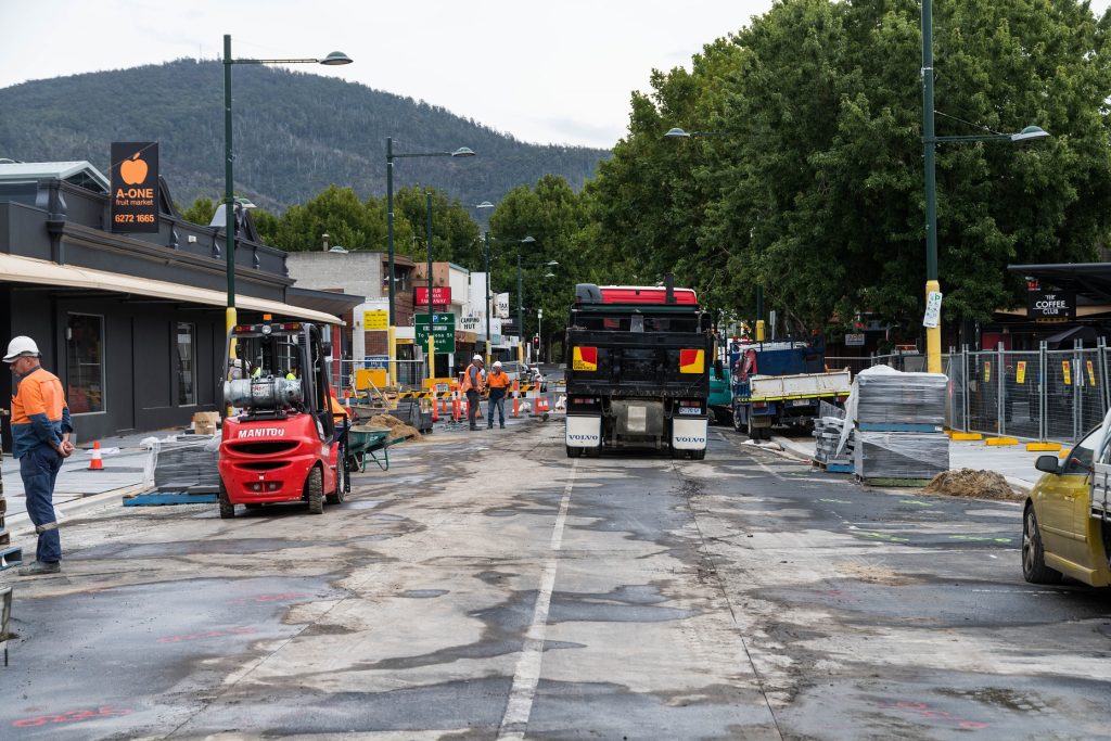
- Resurfacing of up to 7km of roads (2% of network);
- Replacing up to 4 km of footpaths (1% of network);
- Main Road Footpath Renewal (Gavitt to Windsor)
- Abbotsfield Road Footpath Improvement
- Stage 2 of Renfrew Circle Reconstruction (Allardyce to Barron);
- Albert Road Resurfacing
- Giblins Reserve Playground Car Park Extension
- Main Road Granton Shared Path Extension
- Black Spot Projects in Sunmont Street, Chapel Street and Fourth Avenue
- Vulnerable Road User Projects in Main Road Austins Fery and Central Avenue
- Commence the project to repair and reopen the Glenorchy War Memorial Pool
- International Food Garden
- Humphreys Rivulet Rehabilitation
- Playspace renewal at Apex Park (Lutana)
- Public toilet replacement at Poimena Reserve
- Replacement of various picnic shelters, seating, tables and BBQs
- Abbotsfield Park cricket wickets
- Abbotsfield Park lighting replacement
- Redlands Drive Flood Mitigation (sedimentation basin)
- Riverview Parade Stormwater Extension
- Catherine Street Reserve Channel Restoration
- Littlejohn Creek Flood Mitigation (105 Grove Road)
Where are the Planned Works Happening?
We perform ongoing works all year round as part of scheduled maintenance, capital works and operational management of Council’s assets.
To view a map of Council’s assets and planned Capital works, click the link below and select the layer ‘Capital Works’
Scheduled works are subject to change due to weather and other circumstances. If you have any enquiries please contact Council.
Stormwater Works
| Program Name | Status |
| Black Snake Road – drainage upgrade | Deferred |
| Riverview Parade – stormwater extension | Complete |
| Catherine Street Reserve – channel restoration (stage 1) | In Progress |
| Barclay Crescent and Apollo Road | Planned |
| Abbotsfield Road and Hanlon Street – storm diversions | Planned |
| Redlands Drive – flood mitigation works | Planned |
| 21 Sunshine Road – stormwater upgrade | Planned |
| Little John Creek – flood mitigation | Planned |
| Chapel Street Reserve – southern DN300 Replacement – stage 1 | Complete |
| Hamel Street – pipe repair and bank rehabilitation | Complete |
| Bowen Road – relining | Planned |
| Richards Road – roadside drainage improvement | Complete |
| Kalang Avenue – roadside drainage improvement | Complete |
Road Resurfacing
| Reseal Program | Status |
| Cadbury Road – from Box Hill Road to Bilton Street | Complete |
| Main Road – from Johnston Street to Lampton Avenue | Complete |
| Main Road – from Lampton Avenue to Windsor Street | Deferred |
| Main Road – from 247 Main Road to 255 Main Road | Complete |
| Main Road – from Pascoe Avenue to Box Hill Road | Complete |
| Car Park – outside Berriedale Tennis Club | Complete |
| Brent Street – from Tolosa Street to Chapel Street | Complete |
| Garden Grove – from Twelfth Street to Ashgrove Grove | Complete |
| Florence Street – from Main Road to Charles Street | Planned |
| Derwent Park Road – from Brooker Highway to O’Grady Avenue | Complete |
| Derwent Park Road – from O’Grady to Cox Avenue | Complete |
| Derwent Park Road – from Cox Avenue to Bowen Road | Complete |
| Springfield Avenue – from 42 Springfield Avenue to Coleman Street | Planned |
| Springfield Avenue – from Homer Avenue to First Avenue | Planned |
| Berriedale Road – from Main Road to Chardonnay Drive | Complete |
| Marys Hope Road – from Katoomba Crescent to Riverview Parade | Complete |
| Main Road – from Aurora Pole 362 to Aurora Pole 372 | Planned |
| Vehicular Right of Way – from Rocklyn Avenue to Albert Road | Planned |
| Vehicular Right of Way – from Florence Street to Rocklyn Avenue | Planned |
| Devines Road – from Barossa Road to Loftus Street | Complete |
| Jackson Street – from Albion Street to end of the road | Planned |
| Jackson Street – from Chapel Street to Albion Street | Planned |
| Sixth Avenue – from Easton Avenue to Twelfth Avenue | Complete |
| Sixth Avenue – from Eighth Avenue to Easton Avenue | Complete |
| Central Avenue – from Derwent Park Road to the end of the Road | Complete |
| Easton Avenue – from Caversham Road to Sixth Avenue | Complete |
| Galston Road – from Huntley Street to Sussex Street | Complete |
| Tenth Avenue – from Sixth Avenue to Easton Avenue | Complete |
| Walker Street – from Katoomba Crescent to Katoomba Crescent | Complete |
| Fleet Street – from Main Road to Sunderland Street | Complete |
| Ebden Street – from Russell Road to 22 Ebden Street | Complete |
| Lady Clark Avenue – from Main Road to 4 Lady Clark Avenue | Complete |
| Nathan Street – from Chandos Drive to 8 Nathan Street | Complete |
| Centenary Crescent – from Dalgety Street to End Of Road | Complete |
| Montrose Road – from 124 Montrose Road to Nielson Drive | Planned |
| Albert Road – from Main Road to Station Street | Planned |
| Albert Road – from Station Street to Gatehouse Street | Planned |
| Albert Road – from Gatehouse Street to Central Avenue | Planned |
| Chardonnay Drive – from Berriedale Road to Cabernet Drive | Complete |
| Berriedale Road – from Chandos Drive to Croome Court | Planned |
| Tolosa Street – from Clydesdale to Brent Street | Planned |
| Tolosa Street – from Brent Street to Barossa | Planned |
Bridge Renewal
| Program Name | Status |
| New Town Rivulet – walkway undermining repair | In Progress |
| Islet Rivulet – abutment repointing | Complete |
| GASP Walkway Bridge Corrosion Protection Works | Planned |
Footpath Renewal
| Program Name | Status |
| Main Road – from Gavitt Street to Windsor Street footpath replacement | Planned |
| Abbotsfield Road | In Progress |
| Left footpath on Kilpa Street – Allunga Road to Junee Street | Complete |
| Right footpath on Kilpa Street – Allunga Road to Junee Street | Complete |
| Left footpath on Howard Road – Dodds Avenue to Gepp Parade | Planned |
| Right footpath on Howard Road – Dodds Avenue to Gepp Parade | Planned |
| Left footpath on Howard Road – Gepp Parade to House no. 96 | Planned |
| Left footpath on Howard Road – House no. 96 to Havelock Avenue | Planned |
| Left footpath on Grove Road – Anfield Street to Penguin Drive | Complete |
| Left footpath on Grove Road – Roseville Place to Main Road | Complete |
| Right footpath on Grove Road – Roseville Place to Main Road | Complete |
| Right footpath on Grove Road – Anfield Street to Penguin Drive | Complete |
| Left footpath on Grove Road – Penguin Drive to Roseville Place | Complete |
| Right footpath on Grove Road – Penguin Drive to Roseville Place | Complete |
| Left footpath on Aldridge Court – Chatterton Court to House no. 16 | Complete |
| Left footpath – Milton Crescent to Lawson Street (Court Bowl) | Complete |
| Right footpath – Milton Crescent to Lawson Street (Court Bowl) | Complete |
| Left side KC on Kanella Avenue – from Kardilla Court to Junee Street | Complete |
| Left footpath on Tamboon Road – Moondah Drive to Jimbirn Street | In Progress |
| Footpath at Glenorchy Recreation Ground | Deferred |
| Footpath from First Bowls Green to the corner boundary of Glenview Home | Deferred |
| Right footpath on Hamel Street – to the end of the road | Complete |
| Right footpath on Adelphi Road – Abbotsfield Road to Esdaile Street | Planned |
| Left footpath on Adelphi Road – Abbotsfield Road to Esdaile Street | Planned |
| Right footpath on Brent Street – Chapel Street to Anthony Place | Complete |
| Left footpath on Brent Street – Chapel Street to Anthony Place | Complete |
| Left footpath on Gormanston Road – Clifford Street to Derwent Park Road | Planned |
| Right footpath on Gormanston Road – Clifford Street to Derwent Park Road | Planned |
| Left footpath on Easton Avenue – Caversham Road to Sixth Avenue | Complete |
New Footpath and Cycleway Construction
| Program Name | Status |
| Main Road Granton – shared path – Stage 2A | Planned |
| Main Road – Sealed Shoulder for Cyclists | Planned |
Pavement Rehabilitation
| Program Name | Estimated Start Date | Estimated Finish Date | Percentage Complete |
| Cammeray Road – from Bradfield Street to Spring Street – (Stage 1) | Tue 27/5/25 | Thu 28/08/25 | 100% |
| Renfrew Circle Road – reconstruction and traffic improvement – (Stage 2) | Fri 13/8/25 | Mon 27/4/26 | 0% |
| Florence Street – from Charles Street to Kelvin Avenue | Thu 12/2/26 | Wed 20/5/26 | 0% |
| Albert Road – from Main Road to Station Street | Thu 5/3/25 | Thu 9/4/25 | 0% |
| Box Hill Road – from Centenary Crescent to Box Hill Road (Stage 1) | Mon 10/11/25 | Mon 24/11/25 | 0% |
| Howard Road Parking Lane Reconstruction (Bunnings) | Mon 2/2/26 | Mon 4/3/26 | 0% |
| Collinsvale Road – from Aurora Pole 15 to Stone Culvert | Mon 5/1/26 | Wed 4/2/26 | 0% |
| Molesworth Road Upgrade – Stage 1 | Thu 5/2/26 | Tue 14/4/26 | 0% |
Road User Safety Improvement
| Program Name | Status |
| Access Project 1 – Central Avenue to Garden Road kerb | Complete |
| Bilton Street Access to Cycleway | Planned |
| City Wide Road Signage Replacement | Planned |
| Main Road – safety barrier and footpath | In Progress |
| Grove Road Rail Crossing | Complete |
| Canberra Road – guard rail works | Complete |
| Knights Point Reserve – car park | Planned |
| Summont Street – safety barrier | Planned |
| Chapel Street – safety barrier | Complete |
| Fourth Avenue – high friction seal | Planned |
| Giblins Reserve Playground – car park extension | In Progress |
Rural Road Failure Repairs
| Program Name | Status |
| Mount Hull Road, Collinsvale – Safety Improvement Works | Planned |
| Cammeray Road – from Bradfield Steet to Spring Street | Complete |
| Renfrew Circle Reconstruction and Traffic Improvements – Stage 2 | In Progress |
| Florence Street – from Charles Street to Kelvin Avenue / Loscomber Court | Planned |
| Box Hill Road – from Centenary Crescent to Box Hill Road | In Progress |
| Howard Road Parking Lane Reconstruction (Bunnings) | Planned |
| Collinsvale Road – from Aurora Pole 15 to Stone Culvert | Deferred |
| Ashbourne Grove – Deeplift | Complete |
| Molesworth Road Upgrade – Stage 1 | Planned |
| Heavy Patching – Various locations | Complete |